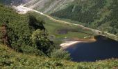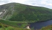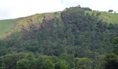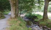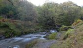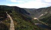

Spinc and Glenealo Valley
SityTrail - itinéraires balisés pédestres
Tous les sentiers balisés d’Europe GUIDE+

Länge
9,2 km

Maximale Höhe
506 m

Positive Höhendifferenz
408 m

Km-Effort
14,6 km

Min. Höhe
134 m

Negative Höhendifferenz
401 m
Boucle
Ja
Kennzeichnung
Erstellungsdatum :
2025-02-06 12:45:31.239
Letzte Änderung :
2025-02-06 12:45:31.239
3h19
Schwierigkeit : Einfach

Kostenlosegpshiking-Anwendung
Über SityTrail
Tour Zu Fuß von 9,2 km verfügbar auf Unbekannt, County Wicklow, The Municipal District of Wicklow. Diese Tour wird von SityTrail - itinéraires balisés pédestres vorgeschlagen.
Beschreibung
Tour erstellt von National Parks and Wildlife Service.
Ort
Land:
Ireland
Region :
Unbekannt
Abteilung/Provinz :
County Wicklow
Kommune :
The Municipal District of Wicklow
Standort:
Brockagh
Gehen Sie:(Dec)
Gehen Sie:(UTM)
678077 ; 5876100 (29U) N.
Kommentare
Touren in der Umgebung
Saint Kevin's Way


Zu Fuß
Einfach
The Municipal District of Wicklow,
Unbekannt,
County Wicklow,
Ireland

6,6 km | 10,2 km-effort
2h 19min
Nein
Glendalough


Wandern
Medium
The Municipal District of Wicklow,
Unbekannt,
County Wicklow,
Ireland

9,4 km | 13,7 km-effort
2h 21min
Ja

Glendalough


Wandern
Medium
The Municipal District of Wicklow,
Unbekannt,
County Wicklow,
Ireland

9,6 km | 14 km-effort
2h 59min
Ja

Mountain Hike from Glendalough car park


Wandern
Sehr leicht
The Municipal District of Wicklow,
Unbekannt,
County Wicklow,
Ireland

17,2 km | 26 km-effort
6h 1min
Ja

The Brockaghs and St Kevins Road


Wandern
Sehr leicht
The Municipal District of Wicklow,
Unbekannt,
County Wicklow,
Ireland

16,7 km | 25 km-effort
Unbekannt
Ja

Arts Lough and Lugnaquilla


Wandern
Sehr leicht
The Municipal District of Arklow,
Unbekannt,
County Wicklow,
Ireland

12,4 km | 23 km-effort
Unbekannt
Ja

glendalough outer circuit


Wandern
Sehr leicht
The Municipal District of Wicklow,
Unbekannt,
County Wicklow,
Ireland

21 km | 33 km-effort
Unbekannt
Ja

Camaderry


Andere Aktivitäten
Sehr leicht
The Municipal District of Wicklow,
Unbekannt,
County Wicklow,
Ireland

8,8 km | 15,8 km-effort
Unbekannt
Ja

Camaderry


Andere Aktivitäten
Sehr leicht
The Municipal District of Wicklow,
Unbekannt,
County Wicklow,
Ireland

12,6 km | 20 km-effort
Unbekannt
Ja


 SityTrail


